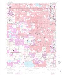
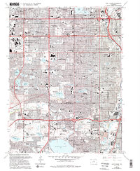
1965 Map of Fort Logan
USGS Topo · Published 1980About this map
The Denver Federal Center and the extensive grounds of the Fort Logan National Cemetery anchor this mid-1960s landscape, showing the rapid suburban expansion southwest of Denver. The area's development is heavily influenced by a sophisticated water management network, including the Moffat Filtration Plant and massive storage reservoirs like Marston Lake and Main Reservoir. The map documents a transition from institutional and agricultural land use to dense residential neighborhoods, marked by the proliferation of shopping centers such as Westland Shopping Center and Athmar Shopping Center. Educational and correctional institutions, including Loretto Heights College and the Federal Correctional Institute, sit alongside recreational spaces like Green Gables Country Club. Industrial and transport corridors follow the Platte River and the Colorado and Southern RR, defining the eastern edge of Sheridan and Englewood.
Find a feature on this map
113 named features on this map. Tap any name to fly to it.
Don’t see what you’re looking for? This feature index may not catch every label — zoom into the map to look around manually.
Map Details
Editions of this 1965 Fort Logan Map
5 editions found
Other maps of this area

1890 · East Denver
USGS Topo · 1:125,000

1899 · West Denver
USGS Topo · 1:125,000

1935 · East Denver Nos. 3 and 4
USGS Topo · 1:48,000

1938 · Morrison
USGS Topo · 1:24,000

1938 · Derby
USGS Topo · 1:24,000

1939 · Golden
USGS Topo · 1:24,000

1940 · Englewood
USGS Topo · 1:31,680

1940 · Derby
USGS Topo · 1:31,680

1941 · Arvada
USGS Topo · 1:31,680

1941 · Fort Logan
USGS Topo · 1:31,680