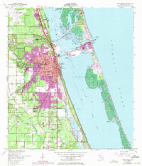
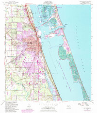
1949 Map of Fort Pierce
USGS Topo · Published 1971About this map
Fort Pierce and the surrounding coastline of St. Lucie County are shown here during a period of significant mid-century expansion. The development of Sunland Gardens and Paradise Park contrasts with the older settlement patterns of White City, where the White City Cem and established citrus groves define the inland character. The vital transport corridor of the Florida East Coast railroad parallels the shoreline, supporting the regional economy alongside the St Lucie County Airport to the northwest.
Find a feature on this map
50 named features on this map. Tap any name to fly to it.
Don’t see what you’re looking for? This feature index may not catch every label — zoom into the map to look around manually.
Map Details
Editions of this 1949 Fort Pierce Map
6 editions found
Other maps of this area

1948 · Ankona
USGS Topo · 1:24,000

1948 · Eden
USGS Topo · 1:24,000

1948 · Indrio
USGS Topo · 1:24,000

1949 · Fort Pierce
USGS Topo · 1:24,000

1949 · Oslo
USGS Topo · 1:24,000

1949 · Fort Pierce NW
USGS Topo · 1:24,000

1950 · Ankona
USGS Topo · 1:24,000

1950 · Fort Pierce
USGS Topo · 1:24,000

1950 · Fort Pierce NW
USGS Topo · 1:24,000

1950 · Oslo
USGS Topo · 1:24,000