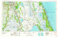
1959 Map of Fort Pierce
USGS Topo · Published 1959About this map
Lake Okeechobee and the vast central Florida interior dominate this mid-century landscape, revealing a region defined by its hydrography and agricultural development. The map details the complex drainage systems of the Kissimmee River and St Johns River Marsh, while showing the established groves and settlements of the citrus belt. Massive inland water bodies like Lake Istokpoga and Lake Kissimmee are surrounded by extensive marshlands, contrasting with the coastal development along the Indian River and the North Atlantic Ocean.
Find a feature on this map
121 named features on this map. Tap any name to fly to it.
Don’t see what you’re looking for? This feature index may not catch every label — zoom into the map to look around manually.
Map Details
Editions of this 1959 Fort Pierce Map
3 editions found

Other maps of this area

1944 · Plant City
USGS Topo · 1:31,680

1944 · Lakeland
USGS Topo · 1:31,680

1944 · Auburndale
USGS Topo · 1:31,680

1948 · Palm City
USGS Topo · 1:24,000

1948 · Ankona
USGS Topo · 1:24,000

1948 · Rood
USGS Topo · 1:24,000

1948 · St. Lucie Inlet
USGS Topo · 1:24,000

1948 · Gomez
USGS Topo · 1:24,000

1948 · Hobe Sound
USGS Topo · 1:24,000

1948 · Jupiter
USGS Topo · 1:24,000