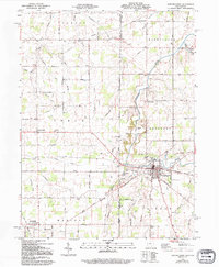
1960 Map of Fort Recovery
USGS Topo · Published 1994About this map
Fort Recovery serves as the focal point of this borderland landscape, situated precisely where the Indiana Ohio state line meets the historic Greenville Treaty Line. This 1960 era survey reveals a countryside shaped by both 18th-century military history and 20th-century agriculture, where the upper Wabash River and its tributaries like Limberlost Creek and Stony Creek wind through a grid of section roads and drainage projects.
Find a feature on this map
67 named features on this map. Tap any name to fly to it.
Don’t see what you’re looking for? This feature index may not catch every label — zoom into the map to look around manually.
Map Details
Editions of this 1960 Fort Recovery Map
2 editions found
Other maps of this area

1908 · St. Henry
USGS Topo · 1:62,500

1911 · Berne
USGS Topo · 1:48,000

1914 · Celina
USGS Topo · 1:62,500

1915 · Fort Recovery
USGS Topo · 1:48,000

1918 · Fort Recovery
USGS Topo · 1:62,500

1944 · Celina
USGS Topo · 1:62,500

1953 · Muncie
USGS Topo · 1:250,000

1956 · Muncie
USGS Topo · 1:250,000

1960 · Fort Recovery
USGS Topo · 1:24,000
1960 · Erastus
USGS Topo · 1:24,000