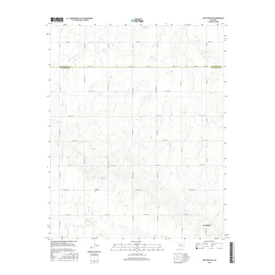
2016 Map of Fort Reno NE
USGS Topo · Published 2016About this map
The Canadian Valley Cem stands as a central landmark in this prairie landscape, reflecting the long-established rural community between the northern boundary of El Reno and the Kingfisher County line. This area of central Oklahoma is defined by a grid-like network of section roads, including N Fort Reno Rd and N Calumet Rd, which facilitate the region's agricultural productivity. Water sources are vital to this terrain, with the N Canadian River winding through the southern section of the quadrangle. Other hydrological features like Winter Camp Cr and the small Oknoname 8 Lake provide essential drainage and storage for the surrounding farms. The proximity of N Airport Rd to the city limits indicates the early 21st-century interface between local transportation infrastructure and the spreading urban reach of the county seat.
Find a feature on this map
29 named features on this map. Tap any name to fly to it.
Don’t see what you’re looking for? This feature index may not catch every label — zoom into the map to look around manually.
Map Details
Editions of this 2016 Fort Reno NE Map
This is the sole edition of this map. No revisions or reprints were ever made.
Other maps of this area

1892 · Kingfisher
USGS Topo · 1:125,000

1893 · Fort Reno
USGS Topo · 1:62,500

1893 · Loyal
USGS Topo · 1:62,500

1895 · Kingfisher
USGS Topo · 1:125,000

1941 · Fort Reno
USGS Topo · 1:62,500

1942 · Fort Reno
USGS Topo · 1:62,500

1949 · Fort Reno
USGS Topo · 1:62,500

1954 · Oklahoma City
USGS Topo · 1:250,000

1955 · Clinton
USGS Topo · 1:250,000

1957 · Clinton
USGS Topo · 1:250,000