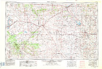
1954 Map of Fort Sumner
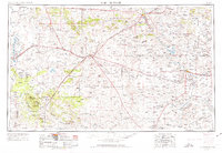
USGS Topo · Published 1983About this map
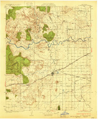
Pecos River ranching and the arrival of major rail lines define this mid-century view of East-Central New Mexico. The map centers on the historical junction at Vaughn, where the Southern Pacific and Atchison Topeka and Santa Fe railroads intersect, facilitating the movement of livestock and goods across the high plains. In the eastern portion, the town of Fort Sumner serves as a local hub near the site of Billy the Kids Grave, a landmark of the era's frontier history. To the northwest, the settlement of Santa Rosa and the old village of Puerto de Luna mark the upper reaches of the river valley. The landscape is characterized by prominent mesas and draws, such as Duran Mesa and Rattlesnake Draw, alongside a network of U.S. highways including U.S. 60 and U.S. 54 that connected these scattered cattle-country outposts.
Find a feature on this map
76 named features on this map. Tap any name to fly to it.
Don’t see what you’re looking for? This feature index may not catch every label — zoom into the map to look around manually.
Map Details
Editions of this 1954 Fort Sumner Map
3 editions found

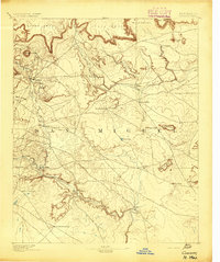
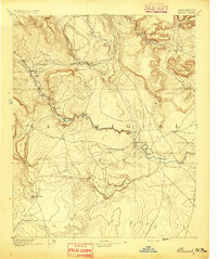
Other maps of this area

1890 · Bernal
USGS Topo · 1:125,000

1891 · Bernal
USGS Topo · 1:125,000

1892 · San Pedro
USGS Topo · 1:125,000

1892 · Corazon
USGS Topo · 1:125,000
1894 · Corazon
USGS Topo · 1:125,000
1894 · Bernal
USGS Topo · 1:125,000

1894 · Lamy
USGS Topo · 1:125,000

1917 · Estancia
USGS Topo · 1:125,000

1918 · Oscura Peak
USGS Topo · 1:125,000
1930 · Tucumcari
USGS Topo · 1:125,000