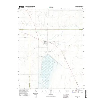
2016 Map of Fort Supply
USGS Topo · Published 2016About this map
Fort Supply sits at the convergence of the Beaver River and Wolf Creek, a historic location that serves as the nexus for northwestern Oklahoma's transport and water management. The landscape is dominated by the Fort Supply Reservoir to the south, while the town grid itself is anchored by Broadway and Reservation Ave. This 2016 survey illustrates the meeting of three counties—Harper, Ellis, and Woodward—highlighting the area's importance as a regional crossroads where US Highway 270 and US Highway 183 intersect. For local historians, the inclusion of the Fort Supply Hospital Cemetery and the Fairlawn Cemetery provides specific points for genealogical research, while the surrounding section roads like N1940 Rd and E0290 Rd reveal the enduring structure of the rural Oklahoma grid system.
Find a feature on this map
37 named features on this map. Tap any name to fly to it.
Don’t see what you’re looking for? This feature index may not catch every label — zoom into the map to look around manually.
Map Details
Editions of this 2016 Fort Supply Map
This is the sole edition of this map. No revisions or reprints were ever made.
Other maps of this area

1955 · Woodward
USGS Topo · 1:250,000

1958 · Woodward
USGS Topo · 1:250,000

1969 · Fargo
USGS Topo · 1:24,000

1969 · Fargo NW
USGS Topo · 1:24,000

1969 · Woodward
USGS Topo · 1:24,000

1970 · Sleeping Bear Creek SW
USGS Topo · 1:24,000

1970 · Sleeping Bear Creek NW
USGS Topo · 1:24,000

1971 · May East
USGS Topo · 1:24,000

1971 · Fort Supply
USGS Topo · 1:24,000

1971 · Fort Supply NW
USGS Topo · 1:24,000