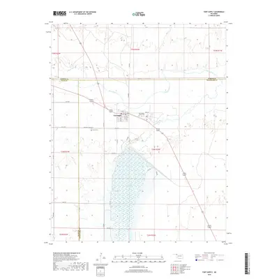
2018 Map of Fort Supply
USGS Topo · Published 2018About this map
Fort Supply sits at the convergence of vital waterways in Northwest Oklahoma, where the Beaver River and Wolf Creek meet. This 2018 survey illustrates the modern landscape of this historic military site, now dominated by the expansive Fort Supply Reservoir. The town's grid remains clear with street names like Wolf Ave, Main St, and Custer Ave hinting at its frontier origins. To the east and south of the town center, the Fort Supply Hospital Cemetery and Fairlawn Cemetery along Fairlawn Cemetary Road provide significant points of interest for genealogists tracing local families. The map also delineates the complex county boundaries where Harper, Ellis, and Woodward counties intersect, reflecting the administrative evolution of this prairie region.
Find a feature on this map
40 named features on this map. Tap any name to fly to it.
Don’t see what you’re looking for? This feature index may not catch every label — zoom into the map to look around manually.
Map Details
Editions of this 2018 Fort Supply Map
This is the sole edition of this map. No revisions or reprints were ever made.
Other maps of this area

1955 · Woodward
USGS Topo · 1:250,000

1958 · Woodward
USGS Topo · 1:250,000

1969 · Fargo
USGS Topo · 1:24,000

1969 · Fargo NW
USGS Topo · 1:24,000

1969 · Woodward
USGS Topo · 1:24,000

1970 · Sleeping Bear Creek SW
USGS Topo · 1:24,000

1970 · Sleeping Bear Creek NW
USGS Topo · 1:24,000

1971 · May East
USGS Topo · 1:24,000

1971 · Fort Supply
USGS Topo · 1:24,000

1971 · Fort Supply NW
USGS Topo · 1:24,000