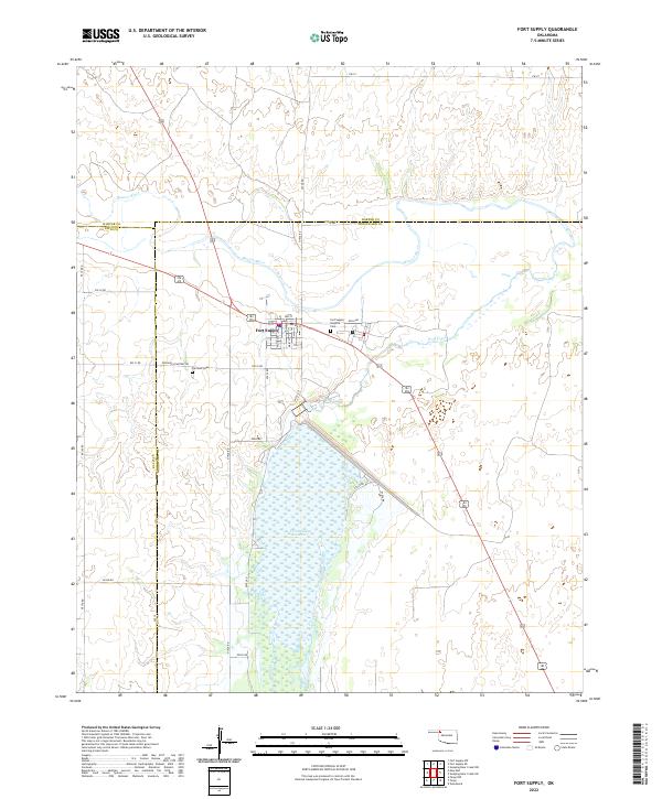
2022 Map of Fort Supply
USGS Topo · Published 2022About this map
Fort Supply serves as the central hub of this Northwest Oklahoma landscape, situated at the strategic confluence where the Beaver River and Wolf Creek meet. This area reflects a deep-rooted history of frontier military presence and regional infrastructure, anchored by the expansive Fort Supply Reservoir. The map provides specific detail for local researchers and genealogists, particularly through the presence of the Fort Supply Hospital Cem and Fairlawn Cem located just west of the town center. The grid of the settlement is clearly defined by streets like Main St and Wolf Ave, while a network of rural roads such as Fairlawn Cemetary Rd and D1933 Rd extend into the surrounding plains. The boundaries of Harper, Ellis, and Woodward Counties intersect here, highlighting the community's role as a tri-county landmark.
Find a feature on this map
41 named features on this map. Tap any name to fly to it.
Don’t see what you’re looking for? This feature index may not catch every label — zoom into the map to look around manually.
Map Details
Editions of this 2022 Fort Supply Map
This is the sole edition of this map. No revisions or reprints were ever made.
Other maps of this area

1955 · Woodward
USGS Topo · 1:250,000

1958 · Woodward
USGS Topo · 1:250,000

1969 · Fargo
USGS Topo · 1:24,000

1969 · Fargo NW
USGS Topo · 1:24,000

1969 · Woodward
USGS Topo · 1:24,000

1970 · Sleeping Bear Creek SW
USGS Topo · 1:24,000

1970 · Sleeping Bear Creek NW
USGS Topo · 1:24,000

1971 · May East
USGS Topo · 1:24,000

1971 · Fort Supply
USGS Topo · 1:24,000

1971 · Fort Supply NW
USGS Topo · 1:24,000