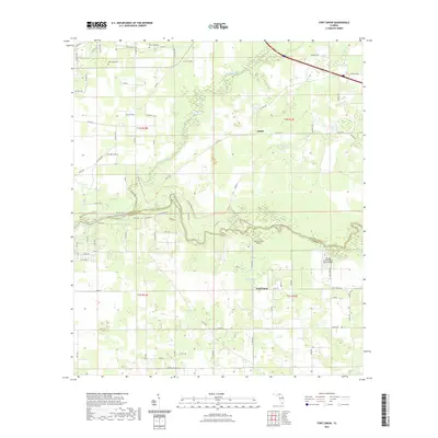
2021 Map of Fort Union
USGS Topo · Published 2021About this map
The Suwannee River and Alapaha River converge in this northern Florida landscape, defining the boundary between Hamilton and Suwannee Counties. The area remains largely rural and water-dominated, characterized by numerous sinkhole features such as Eleven Ponds and Cypress Pond. Local aviation history is represented by the Pittman Oaks Airport and the Florida Sheriffs Boys Ranch Airport, located near the southern reaches of the river bends. For those tracing local roots, the map identifies small community centers like Adams and Fort Union, along with family-interest sites including New Hope Cem and West Lake Cem. Modern conservation and recreation are evident through the path of the Florida National Scenic Trl, which winds along the river bluffs, while the surrounding terrain is a network of numbered county roads and trails that reveal the late 20th-century development of this interior riverine corridor.
Find a feature on this map
86 named features on this map. Tap any name to fly to it.
Don’t see what you’re looking for? This feature index may not catch every label — zoom into the map to look around manually.
Map Details
Editions of this 2021 Fort Union Map
This is the sole edition of this map. No revisions or reprints were ever made.
Other maps of this area

1954 · Valdosta
USGS Topo · 1:250,000

1955 · Jasper
USGS Topo · 1:24,000

1956 · Jennings
USGS Topo · 1:24,000

1956 · Octahatchee
USGS Topo · 1:24,000

1958 · Valdosta
USGS Topo · 1:250,000

1958 · Fort Union
USGS Topo · 1:24,000

1959 · Valdosta
USGS Topo · 1:250,000

1959 · Ellaville
USGS Topo · 1:24,000

1959 · Live Oak West
USGS Topo · 1:24,000

1959 · Falmouth
USGS Topo · 1:24,000