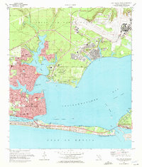
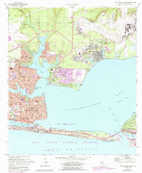
1970 Map of Fort Walton Beach
USGS Topo · Published 1972About this map
Eglin Air Force Base dominates the northern landscape of this coastal survey, where the US Government Railroad cuts through the pine-covered terrain to serve the airfield and the residential enclave of Eglin Village. The map captures the rapid mid-century expansion of Fort Walton Beach, illustrating a densely developed urban grid that transitions into neighboring communities like Ocean City and Cinco Bayou. Along the waterfront, the complex geography of Garnier Bayou and Poquito Bayou shapes the local infrastructure, with numerous marinas and the Intracoastal Waterway connecting the protected harbors to the Choctawhatchee Bay.
Find a feature on this map
72 named features on this map. Tap any name to fly to it.
Don’t see what you’re looking for? This feature index may not catch every label — zoom into the map to look around manually.
Map Details
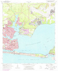
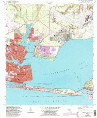
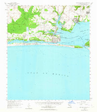
Editions of this 1970 Fort Walton Beach Map
4 editions found
Historical Maps of Fort Walton Beach Through Time
10 maps found
1956 Fort Walton Beach
Okaloosa County, FL
1970 Fort Walton Beach
Okaloosa County, FL
1978 Fort Walton Beach
Okaloosa County, FL
1994 Fort Walton Beach
Okaloosa County, FL

2012 Fort Walton Beach
Okaloosa County, FL

2015 Fort Walton Beach
Okaloosa County, FL

2018 Fort Walton Beach
Okaloosa County, FL

2021 Fort Walton Beach
Okaloosa County, FL

2024 Fort Walton Beach
Okaloosa County, FL
2025 Fort Walton Beach
Okaloosa County, FL