
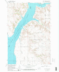
1968 Map of Fort Yates NE
USGS Topo · Published 1971About this map
Lake Oahe Missouri River dominates this landscape on the border of Sioux and Emmons counties, illustrating the controlled inundation of the Missouri River Basin during the late 1960s. The map reveals the expansive Winona Flats along the western shoreline, part of the Standing Rock Indian Reservation. This area shows the impact of mid-century water management on the local terrain, with vast sections of the river valley transformed into a massive reservoir.
Find a feature on this map
11 named features on this map. Tap any name to fly to it.
Don’t see what you’re looking for? This feature index may not catch every label — zoom into the map to look around manually.
Map Details
Editions of this 1968 Fort Yates NE Map
2 editions found
Other maps of this area

1954 · Bismarck
USGS Topo · 1:250,000

1958 · Bismarck
USGS Topo · 1:250,000

1968 · Cannon Ball SE
USGS Topo · 1:24,000

1968 · Fort Yates NW
USGS Topo · 1:24,000

1968 · Fort Yates SE
USGS Topo · 1:24,000

1968 · Fort Yates
USGS Topo · 1:24,000

1968 · Cannon Ball SW
USGS Topo · 1:24,000

1971 · Grassna NW
USGS Topo · 1:24,000
1971 · Kiefer Buttes
USGS Topo · 1:24,000

1971 · Hazelton SW
USGS Topo · 1:24,000