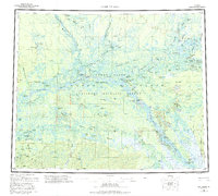
1956 Map of Fort Yukon
USGS Topo · Published 1995About this map
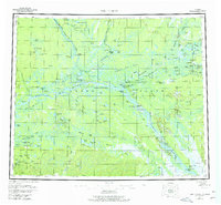
The Arctic Circle crosses through this expansive survey of the Yukon Flats, where the Yukon River and Porcupine River converge. Settlement is concentrated along these vital waterways and the Chandalar River, with indigenous sites and seasonal camps like Alexanders Village, Venetie Landing, and Twentytwo Mile Village punctuating the vast wetland landscape. The interior is a complex network of sloughs and lakes, including the Black River Slough and Seventeenmile Slough, which were essential for transport and subsistence in the mid-20th century.
Find a feature on this map
67 named features on this map. Tap any name to fly to it.
Don’t see what you’re looking for? This feature index may not catch every label — zoom into the map to look around manually.
Map Details
Editions of this 1956 Fort Yukon Map
7 editions found

Other maps of this area

1945 · Livengood
USGS Topo · 1:250,000

1951 · Fort Yukon
USGS Topo · 1:250,000

1951 · Charley River
USGS Topo · 1:250,000

1951 · Black River
USGS Topo · 1:250,000

1951 · Coleen
USGS Topo · 1:250,000

1951 · Chandalar
USGS Topo · 1:250,000

1951 · Livengood
USGS Topo · 1:250,000

1951 · Christian
USGS Topo · 1:250,000

1951 · Beaver
USGS Topo · 1:250,000

1951 · Circle
USGS Topo · 1:250,000