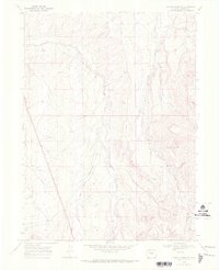
1969 Map of Fortification NE
USGS Topo · Published 1972About this map
Fourmile Creek and Willow Creek carve through the high country of Moffat County in this late 1960s topographic study. The landscape is characterized by its drainage patterns and industrial utility, rather than permanent settlements. Modern energy infrastructure is evident through the presence of a Pipeline and a Gas Well located south of the township line between T. 12 N. and T. 11 N.. The terrain is navigated by a network of seasonal routes, including a Jeep Trail that follows the contours of Mud Spring Draw. Hydrological monitoring is also documented at a Gaging Sta along the southern reaches of Willow Creek. This map captures a specific moment in the mid-century development of Colorado's rural resource lands, focusing on water management and early energy extraction routes.
Find a feature on this map
8 named features on this map. Tap any name to fly to it.
Don’t see what you’re looking for? This feature index may not catch every label — zoom into the map to look around manually.
Map Details
Editions of this 1969 Fortification NE Map
2 editions found
Other maps of this area

1916 · Craig
USGS Topo · 1:125,000

1932 · Savery
USGS Topo · 1:96,000

1940 · Savery
USGS Topo · 1:125,000

1954 · Rawlins
USGS Topo · 1:250,000

1954 · Craig
USGS Topo · 1:250,000

1957 · Craig
USGS Topo · 1:250,000

1957 · Baggs
USGS Topo · 1:62,500

1958 · Rawlins
USGS Topo · 1:250,000

1958 · Craig
USGS Topo · 1:250,000

1960 · Craig
USGS Topo · 1:250,000