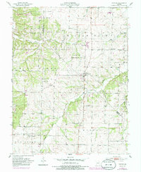
1952 Map of Fortuna
USGS Topo · Published 1986About this map
The boundary between Morgan and Moniteau Counties defines the central axis of this landscape, where small crossroads communities and scattered rural institutions anchor the drainage of the Willow Fork. The village of Fortuna sits near the heart of the sheet, while smaller clusters like Akinsville and Glensted appear to the west. This mid-century survey reveals a social infrastructure of family-named cemeteries and rural schoolhouses, such as Hickory Grove Sch and Centennial Sch, many of which were the primary landmarks for farming families before the consolidation of rural districts.
Find a feature on this map
30 named features on this map. Tap any name to fly to it.
Don’t see what you’re looking for? This feature index may not catch every label — zoom into the map to look around manually.
Map Details
Editions of this 1952 Fortuna Map
3 editions found
Other maps of this area

1888 · Versailles
USGS Topo · 1:125,000

1888 · Boonville
USGS Topo · 1:125,000

1893 · Versailles
USGS Topo · 1:125,000

1904 · Eldon
USGS Topo · 1:62,500

1904 · Gravois Mills
USGS Topo · 1:62,500

1947 · Jefferson City
USGS Topo · 1:250,000

1949 · Gravois Mills
USGS Topo · 1:62,500

1951 · Latham
USGS Topo · 1:24,000

1952 · Tipton
USGS Topo · 1:24,000
1952 · Clarksburg
USGS Topo · 1:24,000