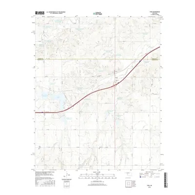
2016 Map of Foss
USGS Topo · Published 2016About this map
The town of Foss sits at a critical intersection of modern infrastructure and rural Oklahoma history, positioned just south of the Custer County and Washita County line. This landscape is defined by an extensive water management network, featuring numerous controlled basins such as Turkey Creek Site 1 and Soldier Creek Watershed Site 11. The presence of Clinton Lake and various watershed sites reflects the mid-century transition toward flood control and agricultural stabilization in the region.
Find a feature on this map
45 named features on this map. Tap any name to fly to it.
Don’t see what you’re looking for? This feature index may not catch every label — zoom into the map to look around manually.
Map Details
Editions of this 2016 Foss Map
This is the sole edition of this map. No revisions or reprints were ever made.
Other maps of this area

1955 · Clinton
USGS Topo · 1:250,000

1957 · Clinton
USGS Topo · 1:250,000

1957 · Butler
USGS Topo · 1:62,500

1957 · Dill City
USGS Topo · 1:62,500

1960 · Hammon
USGS Topo · 1:62,500

1961 · Elk City
USGS Topo · 1:62,500

1976 · Butler SW
USGS Topo · 1:24,000

1976 · Dill City NE
USGS Topo · 1:24,000

1976 · Dill City SE
USGS Topo · 1:24,000
1976 · Butler SE
USGS Topo · 1:24,000