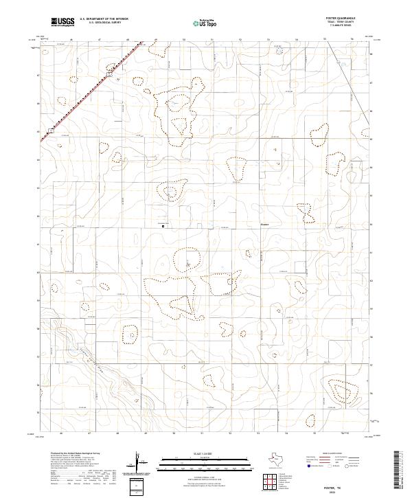
2022 Map of Foster
USGS Topo · Published 2022About this map
Forrester Cem serves as a quiet landmark within the rural landscape of Terry County, situated north of the Foster community. This area of West Texas is characterized by its organized grid of county roads and agricultural land, where names like Co RD 620 and Co RD 365 define the local geography. The most prominent natural feature is Sulphur Springs Draw, which cuts across the southwestern portion of the map, influencing the local topography. Transportation through this section of the High Plains is facilitated by a network of rural routes, including the convergence of highways 62 385 in the northwest and state-maintained roads like Ranch Rd 403 and Fm 213 E. This survey provides a clear view of the land division and water drainage patterns essential to this farming region.
Find a feature on this map
28 named features on this map. Tap any name to fly to it.
Don’t see what you’re looking for? This feature index may not catch every label — zoom into the map to look around manually.
Map Details
Editions of this 2022 Foster Map
This is the sole edition of this map. No revisions or reprints were ever made.
Other maps of this area

1954 · Hobbs
USGS Topo · 1:250,000

1954 · Brownfield
USGS Topo · 1:250,000

1958 · Brownfield
USGS Topo · 1:250,000

1958 · Hobbs
USGS Topo · 1:250,000

1962 · Brownfield
USGS Topo · 1:250,000

1969 · Brownfield East
USGS Topo · 1:24,000

1969 · Gomez
USGS Topo · 1:24,000

1969 · Foster
USGS Topo · 1:24,000

1969 · Loop
USGS Topo · 1:24,000

1969 · Ashmore
USGS Topo · 1:24,000