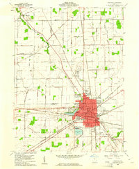
1960 Map of Fostoria
USGS Topo · Published 1961About this map
Fostoria stands as a significant industrial and transit hub at the intersection of Wood, Seneca, and Hancock Counties. In 1960, the city was defined by a dense network of major rail lines, including the New York Central, Chesapeake and Ohio, and Baltimore and Ohio, reflecting its historical importance as a ‘Glass Town’ and manufacturing center. The landscape surrounding the urban core is dotted with local institutions like St Wendelin Ch and numerous neighborhood schools such as Whittier Sch and Bryant Sch.
Find a feature on this map
61 named features on this map. Tap any name to fly to it.
Don’t see what you’re looking for? This feature index may not catch every label — zoom into the map to look around manually.
Map Details
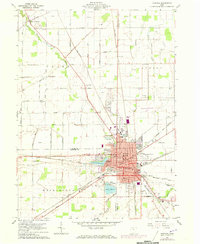
Editions of this 1960 Fostoria Map
2 editions found
Other maps of this area

1901 · Fostoria
USGS Topo · 1:62,500

1901 · Bowling Green
USGS Topo · 1:62,500

1901 · Elmore
USGS Topo · 1:62,500

1903 · Bowling Green
USGS Topo · 1:62,500

1903 · Fostoria
USGS Topo · 1:62,500

1903 · Findlay
USGS Topo · 1:62,500

1903 · Elmore
USGS Topo · 1:62,500

1956 · Toledo
USGS Topo · 1:250,000

1958 · Jerry City
USGS Topo · 1:24,000
1958 · Bradner
USGS Topo · 1:24,000