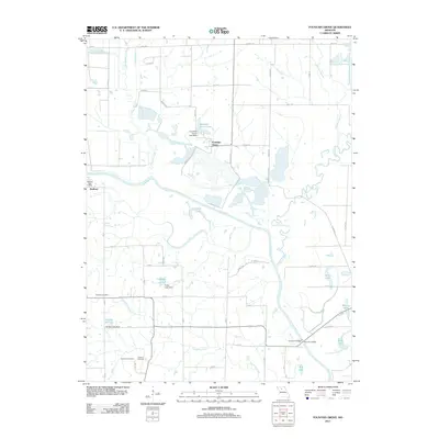
2012 Map of Fountain Grove
USGS Topo · Published 2012About this map
The Grand River meanders through this portion of Linn County, shaping a landscape defined by floodplains and extensive water management. The settlement of Fountain Grove sits north of its namesake Fountain Grove Lake, while the community of Bedford is situated further west near the Bedford Post Office. This area is notable for its intricate network of wetlands and tributaries, including Locust Creek and Towstring Creek, which feed into a series of managed bodies of water such as Eagle Lake and Hog Lake.
Find a feature on this map
37 named features on this map. Tap any name to fly to it.
Don’t see what you’re looking for? This feature index may not catch every label — zoom into the map to look around manually.
Map Details
Editions of this 2012 Fountain Grove Map
This is the sole edition of this map. No revisions or reprints were ever made.
Other maps of this area

1924 · Chula
USGS Topo · 1:62,500

1924 · Hale
USGS Topo · 1:62,500

1946 · Brookfield
USGS Topo · 1:62,500

1947 · Chula
USGS Topo · 1:62,500

1948 · Brookfield
USGS Topo · 1:62,500

1949 · Mendon
USGS Topo · 1:24,000

1949 · Sumner
USGS Topo · 1:24,000

1950 · Sumner
USGS Topo · 1:24,000

1950 · Hale
USGS Topo · 1:24,000

1951 · Hale
USGS Topo · 1:24,000