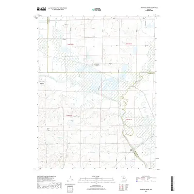
2017 Map of Fountain Grove
USGS Topo · Published 2017About this map
The Grand River dominates this landscape at the intersection of Linn, Livingston, and Chariton counties, winding through a complex system of wetlands and named lakes. The settlement of Fountain Grove sits at the northern edge of this hydrologic network, while Bedford is positioned further west along the river's course. The map reveals an intricate drainage pattern where Locust Creek and Towstring Cr feed into the bottomlands, supporting numerous water bodies such as Eagle Lake, Hog Lake, and Fountain Grove Lake. Cultural history is anchored by the Norfolk railroad line and local burial sites like Fairland Cem and Cameron Cem. This modern topographic study shows how the original river meandering dictates the modern boundaries and road placements, as the extensive marshlands remain largely undeveloped, preserving the character of the Missouri river bottoms.
Find a feature on this map
63 named features on this map. Tap any name to fly to it.
Don’t see what you’re looking for? This feature index may not catch every label — zoom into the map to look around manually.
Map Details
Editions of this 2017 Fountain Grove Map
This is the sole edition of this map. No revisions or reprints were ever made.
Other maps of this area

1924 · Chula
USGS Topo · 1:62,500

1924 · Hale
USGS Topo · 1:62,500

1946 · Brookfield
USGS Topo · 1:62,500

1947 · Chula
USGS Topo · 1:62,500

1948 · Brookfield
USGS Topo · 1:62,500

1949 · Mendon
USGS Topo · 1:24,000

1949 · Sumner
USGS Topo · 1:24,000

1950 · Sumner
USGS Topo · 1:24,000

1950 · Hale
USGS Topo · 1:24,000

1951 · Hale
USGS Topo · 1:24,000