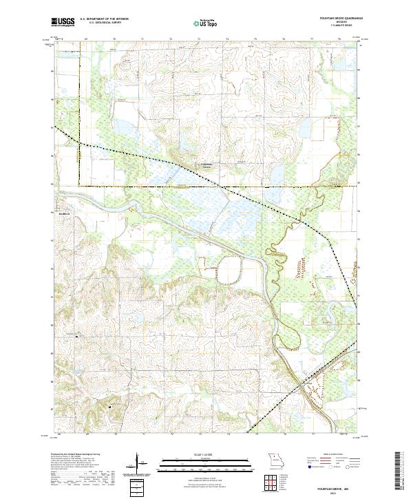
2021 Map of Fountain Grove
USGS Topo · Published 2021About this map
Grand River and its wide floodplain dominate this landscape at the intersection of Livingston, Linn, and Chariton counties. This riverine environment is shaped by numerous oxbows and wetlands, including Eagle Lake, Hughs Lake, and Jacks Lake. The settlement of Fountain Grove sits at a low rise above the marshes, while Bedford occupies the western portion of the quadrangle near Liv 306. The complex network of waterways, featuring Locust Creek and Parson Cr, indicates a region historically defined by its seasonal drainage patterns and alluvial soils.
Find a feature on this map
48 named features on this map. Tap any name to fly to it.
Don’t see what you’re looking for? This feature index may not catch every label — zoom into the map to look around manually.
Map Details
Editions of this 2021 Fountain Grove Map
This is the sole edition of this map. No revisions or reprints were ever made.
Other maps of this area

1924 · Chula
USGS Topo · 1:62,500

1924 · Hale
USGS Topo · 1:62,500

1946 · Brookfield
USGS Topo · 1:62,500

1947 · Chula
USGS Topo · 1:62,500

1948 · Brookfield
USGS Topo · 1:62,500

1949 · Mendon
USGS Topo · 1:24,000

1949 · Sumner
USGS Topo · 1:24,000

1950 · Sumner
USGS Topo · 1:24,000

1950 · Hale
USGS Topo · 1:24,000

1951 · Hale
USGS Topo · 1:24,000