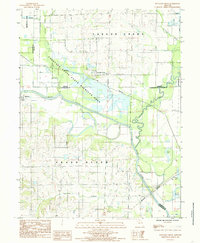
1984 Map of Fountain Grove
USGS Topo · Published 1985About this map
Fountain Grove and the surrounding river bottomlands define this portion of north-central Missouri during the mid-1980s. The landscape is dominated by the confluence of major waterways and the expansive Fountain Grove State Wildlife Area, which preserves a vast system of levees and wetlands along the Grand River and Locust Creek. This map illustrates a complex hydraulic environment where natural oxbows and managed water bodies like Jacks Lake and Hog Lake sit adjacent to active agricultural fields.
Find a feature on this map
20 named features on this map. Tap any name to fly to it.
Don’t see what you’re looking for? This feature index may not catch every label — zoom into the map to look around manually.
Map Details
Editions of this 1984 Fountain Grove Map
This is the sole edition of this map. No revisions or reprints were ever made.
Other maps of this area

1924 · Chula
USGS Topo · 1:62,500

1924 · Hale
USGS Topo · 1:62,500

1946 · Brookfield
USGS Topo · 1:62,500

1947 · Chula
USGS Topo · 1:62,500

1948 · Brookfield
USGS Topo · 1:62,500

1949 · Mendon
USGS Topo · 1:24,000

1949 · Sumner
USGS Topo · 1:24,000

1950 · Sumner
USGS Topo · 1:24,000

1950 · Hale
USGS Topo · 1:24,000

1951 · Hale
USGS Topo · 1:24,000