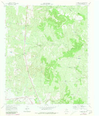
1967 Map of Fourmile Hill
USGS Topo · Published 1981About this map
Finney sits in the northwest reaches of this King County landscape, a region defined by the drainage networks of the Middle Fork Wichita River and the South Wichita River. The topography is dominated by the prominent rise of Fourmile Hill and an extensive system of named windmills that reveal the complex livestock infrastructure of the era. From the Bison Pen Windmills to the West Horse Pasture Windmill, these water sources were vital to the local ranching economy.
Find a feature on this map
31 named features on this map. Tap any name to fly to it.
Don’t see what you’re looking for? This feature index may not catch every label — zoom into the map to look around manually.
Map Details
Editions of this 1967 Fourmile Hill Map
2 editions found
Other maps of this area

1954 · Lubbock
USGS Topo · 1:250,000

1966 · Chalk SW
USGS Topo · 1:24,000

1966 · J Y Ranch
USGS Topo · 1:24,000

1967 · Guthrie NW
USGS Topo · 1:24,000

1967 · Dark Canyon
USGS Topo · 1:24,000

1967 · Fourmile Hill
USGS Topo · 1:24,000

1968 · Grow
USGS Topo · 1:24,000

1968 · Buffalo Creek
USGS Topo · 1:24,000

1968 · Guthrie
USGS Topo · 1:24,000

1968 · Pitchfork Flats
USGS Topo · 1:24,000