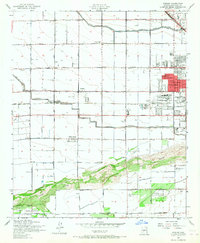
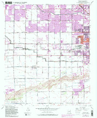
1952 Map of Fowler
USGS Topo · Published 1967About this map
Agricultural life and early aviation define the landscape west of Phoenix in the early 1950s. The region is characterized by a precise grid of roads like Indian School Road and Van Buren Street, intersected by vital irrigation infrastructure including the Grand Canal and the Roosevelt Pacific Canal. These waterways supported established farming communities at Fowler and Cartwright. The eastern edge of the map shows the industrial and institutional expansion of the city, featuring the Aluminum Plant, the County Hospital, and the County Juvenile Home. Aviation is well-represented by Airhaven Airport in the northeast and Air Topia Airport near the Salt River. To the south, the terrain shifts from irrigated fields to the natural landscape of the Gila River Indian Reservation along the banks of the Gila River.
Find a feature on this map
45 named features on this map. Tap any name to fly to it.
Don’t see what you’re looking for? This feature index may not catch every label — zoom into the map to look around manually.
Map Details
Editions of this 1952 Fowler Map
6 editions found
Other maps of this area

1912 · Phoenix
USGS Topo · 1:62,500

1914 · Phoenix
USGS Topo · 1:62,500

1946 · Avondale
USGS Topo · 1:62,500

1948 · Cashion
USGS Topo · 1:62,500

1952 · Lone Butte
USGS Topo · 1:24,000

1952 · Laveen
USGS Topo · 1:24,000

1952 · Phoenix
USGS Topo · 1:24,000

1952 · Fowler
USGS Topo · 1:24,000

1952 · Phoenix
USGS Topo · 1:62,500

1954 · Phoenix
USGS Topo · 1:250,000