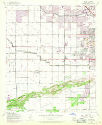
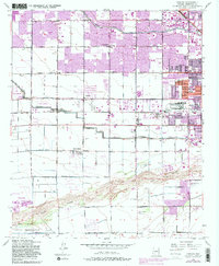
1952 Map of Fowler
USGS Topo · Published 1968About this map
The agricultural fields and emerging suburban corridors west of Phoenix are documented here during a period of rapid transition. The map centers on the small settlements of Fowler and Santa Maria, while the northern portion shows the community of Cartwright and the expanding footprint of Alhambra. Heavy industry and public utilities are visible on the city's periphery, including an Aluminum Plant, a Sewage Disposal site, and an Incinerator. Educational and community infrastructure is well-represented by facilities like the Murphy Sch No 2, Riverside Sch, and the Maricopa County Juvenile Home and Hospital.
Find a feature on this map
41 named features on this map. Tap any name to fly to it.
Don’t see what you’re looking for? This feature index may not catch every label — zoom into the map to look around manually.
Map Details
Editions of this 1952 Fowler Map
6 editions found
Other maps of this area

1912 · Phoenix
USGS Topo · 1:62,500

1914 · Phoenix
USGS Topo · 1:62,500

1946 · Avondale
USGS Topo · 1:62,500

1948 · Cashion
USGS Topo · 1:62,500

1952 · Lone Butte
USGS Topo · 1:24,000

1952 · Laveen
USGS Topo · 1:24,000

1952 · Phoenix
USGS Topo · 1:24,000

1952 · Fowler
USGS Topo · 1:24,000

1952 · Phoenix
USGS Topo · 1:62,500

1954 · Phoenix
USGS Topo · 1:250,000