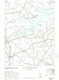
1948 Map of Frankford
USGS Topo · Published 1948About this map
Indian River and its intricate network of tidal guts and coves define this coastal landscape, where life in the late 1940s centered around small river landings and inland agricultural hubs. The Pennsylvania Railroad runs north-to-south through Frankford, connecting the timber and farming districts to larger markets. Along the shoreline, places like Rosedale Beach and Oak Orchard reflect a growing coastal presence, while the interior is marked by long-standing community landmarks such as Old Baltimore Mill and St Georges Church.
Find a feature on this map
106 named features on this map. Tap any name to fly to it.
Don’t see what you’re looking for? This feature index may not catch every label — zoom into the map to look around manually.
Map Details
Editions of this 1948 Frankford Map
2 editions found
Other maps of this area

1901 · Ocean City
USGS Topo · 1:62,500

1902 · Pittsville
USGS Topo · 1:62,500

1917 · Millsboro
USGS Topo · 1:62,500

1918 · Rehoboth
USGS Topo · 1:62,500

1938 · Millsboro
USGS Topo · 1:62,500

1938 · Rehoboth
USGS Topo · 1:62,500

1942 · Ocean City
USGS Topo · 1:62,500

1942 · Whaleysville
USGS Topo · 1:24,000

1943 · Selbyville
USGS Topo · 1:31,680
1943 · Whaleysville
USGS Topo · 1:31,680