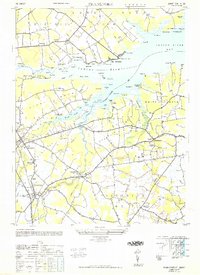
1948 Map of Frankford
USGS Topo · Published 1948About this map
The tidal creeks and marshlands of Indian River Bay define this post-war landscape in Sussex County. The convergence of land and water is marked by several narrow peninsulas, including White Neck and Piney Neck, which were increasingly accessible via the Du Pont Highway. The area reflects a coastal economy in transition, where established inland settlements like Frankford and Dagsboro are complemented by shoreline developments at Oak Orchard and Rosedale Beach. Local education and faith are central to the map's layout, with the John M Clayton School, Antioch School, and St Georges Church serving as community anchors.
Find a feature on this map
81 named features on this map. Tap any name to fly to it.
Don’t see what you’re looking for? This feature index may not catch every label — zoom into the map to look around manually.
Map Details
Editions of this 1948 Frankford Map
2 editions found
Other maps of this area

1901 · Ocean City
USGS Topo · 1:62,500

1902 · Pittsville
USGS Topo · 1:62,500

1917 · Millsboro
USGS Topo · 1:62,500

1918 · Rehoboth
USGS Topo · 1:62,500

1938 · Millsboro
USGS Topo · 1:62,500

1938 · Rehoboth
USGS Topo · 1:62,500

1942 · Ocean City
USGS Topo · 1:62,500

1942 · Whaleysville
USGS Topo · 1:24,000

1943 · Selbyville
USGS Topo · 1:31,680
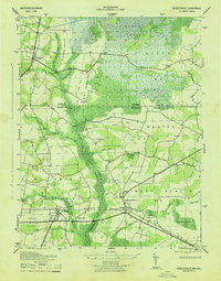
1943 · Whaleysville
USGS Topo · 1:31,680