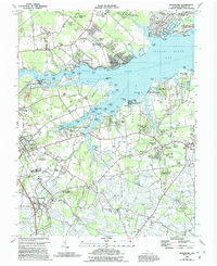
1984 Map of Frankford
USGS Topo · Published 1991About this map
Indian River Bay and its complex network of inlets define this coastal region of Sussex County, where the transition from late 20th-century agriculture to shoreline residential development is well underway. The map records the emergence of numerous mobile home parks and residential enclaves such as Oak Orchard, Black Water Village, and River Village along the tidal fingers of Pepper Creek and Island Creek. Cultural history is anchored by several prominent houses of worship, including the Prince George Chapel and the Nanticoke Indian Center, signaling the deep community roots in the interior neck lands.
Find a feature on this map
137 named features on this map. Tap any name to fly to it.
Don’t see what you’re looking for? This feature index may not catch every label — zoom into the map to look around manually.
Map Details
Editions of this 1984 Frankford Map
2 editions found
Other maps of this area

1901 · Ocean City
USGS Topo · 1:62,500

1902 · Pittsville
USGS Topo · 1:62,500

1917 · Millsboro
USGS Topo · 1:62,500

1918 · Rehoboth
USGS Topo · 1:62,500

1938 · Millsboro
USGS Topo · 1:62,500

1938 · Rehoboth
USGS Topo · 1:62,500

1942 · Ocean City
USGS Topo · 1:62,500

1942 · Whaleysville
USGS Topo · 1:24,000

1943 · Selbyville
USGS Topo · 1:31,680
1943 · Whaleysville
USGS Topo · 1:31,680