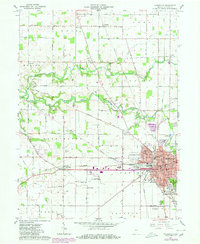
1961 Map of Frankfort
USGS Topo · Published 1980About this map
Frankfort serves as the bustling hub of this Indiana landscape, where the concentrated street grid reveals a community deeply integrated with its transportation infrastructure. The city's growth is clearly marked by the convergence of the Conrail and Norfolk and Western Railway, alongside significant civic landmarks like the County Hospital and County Fairgrounds. Beyond the urban center, the terrain is defined by the winding course of the South Fork Wildcat Creek and Kilmore Creek, which cut through the agricultural surroundings of Ross and Washington townships. Genealogists will find a wealth of local landmarks, from the Jefferson and Bunnel cemeteries to the rural crossroads of Mattix Corner. This 1961 edition, updated with late-1970s revisions, illustrates the expansion of the Frankfort Municipal Airport and the development of suburban features like the Wesley Manor complex.
Find a feature on this map
56 named features on this map. Tap any name to fly to it.
Don’t see what you’re looking for? This feature index may not catch every label — zoom into the map to look around manually.
Map Details
Editions of this 1961 Frankfort Map
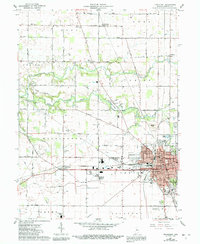
3 editions found
Other maps of this area

1953 · Danville
USGS Topo · 1:250,000

1955 · Danville
USGS Topo · 1:250,000

1956 · Danville
USGS Topo · 1:250,000

1961 · Michigantown
USGS Topo · 1:24,000

1961 · Mulberry
USGS Topo · 1:24,000

1961 · Pyrmont
USGS Topo · 1:24,000

1961 · Mechanicsburg
USGS Topo · 1:24,000

1961 · Rossville
USGS Topo · 1:24,000

1961 · Burlington
USGS Topo · 1:24,000

1961 · Frankfort
USGS Topo · 1:24,000