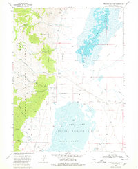
1968 Map of Franklin Lake SW
USGS Topo · Published 1980About this map
The Ruby Mountains dominate the western horizon of this high-desert landscape, where steep slopes within the Humboldt National Forest drop sharply into the Ruby Valley. The interaction between the mountain range and the valley floor is defined by a series of drainages, including Gardner Canyon and Wilson Canyon, which feed into a complex system of marshes and lakes. To the east, the Ruby Lake National Wildlife Refuge and Franklin Lake create a seasonal aquatic environment bordering an expansive Alkali Flat. Human activity in this remote Elko County region is evidenced by mining ventures like the Star Mine and Mines located near Harrison Pass. The presence of Hot Springs and numerous unnamed springs suggests the critical importance of water resources in this arid Great Basin setting during the late 1960s.
Find a feature on this map
32 named features on this map. Tap any name to fly to it.
Don’t see what you’re looking for? This feature index may not catch every label — zoom into the map to look around manually.
Map Details
Editions of this 1968 Franklin Lake SW Map
3 editions found
Other maps of this area

1934 · Jiggs
USGS Topo · 1:125,000

1937 · Jiggs
USGS Topo · 1:125,000

1955 · Elko
USGS Topo · 1:250,000

1958 · Elko
USGS Topo · 1:250,000

1959 · Jiggs
USGS Topo · 1:62,500

1959 · Sherman Mtn
USGS Topo · 1:62,500

1962 · Elko
USGS Topo · 1:250,000

1965 · Elko
USGS Topo · 1:250,000

1968 · Franklin Lake SE
USGS Topo · 1:24,000

1968 · Franklin Lake SW
USGS Topo · 1:24,000