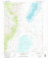
1968 Map of Franklin Lake SW
USGS Topo · Published 1990About this map
The Ruby Mountains dominate the western edge of this 1960s survey, their steep slopes dropping sharply into the marshy basins of the eastern flats. This transition from high-altitude terrain to a desert lake system is marked by the presence of the Ruby Lake National Wildlife Refuge and the Humboldt National Forest. Early industrial activity is evident along the mountain front, where the Star Mine, Lime Mine, and a Kiln indicate the extraction of local minerals and stone.
Find a feature on this map
33 named features on this map. Tap any name to fly to it.
Don’t see what you’re looking for? This feature index may not catch every label — zoom into the map to look around manually.
Map Details
Editions of this 1968 Franklin Lake SW Map
3 editions found
Other maps of this area

1934 · Jiggs
USGS Topo · 1:125,000

1937 · Jiggs
USGS Topo · 1:125,000

1955 · Elko
USGS Topo · 1:250,000

1958 · Elko
USGS Topo · 1:250,000

1959 · Jiggs
USGS Topo · 1:62,500

1959 · Sherman Mtn
USGS Topo · 1:62,500

1962 · Elko
USGS Topo · 1:250,000

1965 · Elko
USGS Topo · 1:250,000

1968 · Franklin Lake SE
USGS Topo · 1:24,000

1968 · Franklin Lake SW
USGS Topo · 1:24,000