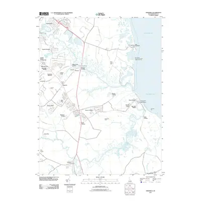
2011 Map of Frederica
USGS Topo · Published 2011About this map
The Saint Jones River and Murderkill River meander through the marshy lowlands of Kent County, defining a landscape shaped by coastal proximity and historical transit. The town of Frederica anchors the southern portion of the sheet near the confluence of Ash Gut, while the settlement of Magnolia serves as a central hub with its Magnolia Post Office. Along the eastern edge, the Delaware Bay shoreline features specialized coastal communities like Bowers Beach, South Bowers, and the uniquely named Kitts Hummock.
Find a feature on this map
53 named features on this map. Tap any name to fly to it.
Don’t see what you’re looking for? This feature index may not catch every label — zoom into the map to look around manually.
Map Details
Editions of this 2011 Frederica Map
This is the sole edition of this map. No revisions or reprints were ever made.
Other maps of this area

1899 · Vineland
USGS Topo · 1:125,000

1899 · Dover
USGS Topo · 1:125,000

1906 · Dover
USGS Topo · 1:125,000

1918 · Cedar Creek
USGS Topo · 1:62,500

1918 · Harrington
USGS Topo · 1:62,500

1919 · Cedar Creek
USGS Topo · 1:62,500

1919 · Vineland
USGS Topo · 1:125,000

1920 · Dover
USGS Topo · 1:125,000

1926 · Wyoming
USGS Topo · 1:48,000

1930 · Wyoming
USGS Topo · 1:62,500