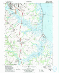
1993 Map of Frederica
USGS Topo · Published 1993About this map
St Jones River and Murderkill River meander toward the Delaware Bay, shaping the landscape of Kent County in the early 1990s. The region is defined by its coastal wildlife management, with extensive tracts like the Ted Harvey State Wildlife Area and Milford Neck State Wildlife Area preserving the wetlands and mud flats east of Magnolia. Inland, the map reveals a pattern of historic river landings such as Barkers Landing and Warren Landing, remnants of a time when these waterways served as primary transportation arteries.
Find a feature on this map
60 named features on this map. Tap any name to fly to it.
Don’t see what you’re looking for? This feature index may not catch every label — zoom into the map to look around manually.
Map Details
Editions of this 1993 Frederica Map
This is the sole edition of this map. No revisions or reprints were ever made.
Other maps of this area

1899 · Vineland
USGS Topo · 1:125,000

1899 · Dover
USGS Topo · 1:125,000

1906 · Dover
USGS Topo · 1:125,000

1918 · Cedar Creek
USGS Topo · 1:62,500

1918 · Harrington
USGS Topo · 1:62,500

1919 · Cedar Creek
USGS Topo · 1:62,500

1919 · Vineland
USGS Topo · 1:125,000

1920 · Dover
USGS Topo · 1:125,000

1926 · Wyoming
USGS Topo · 1:48,000

1930 · Wyoming
USGS Topo · 1:62,500