1955 Map of Fredericksburg
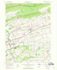
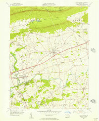
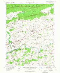
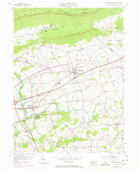
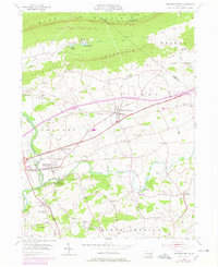
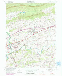
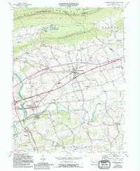
USGS Topo · Published 1971About this map
Blue Mountain and Little Mountain define the northern horizon of this Lebanon County landscape, with the Appalachian Trail following the ridge across the county line. Below the slopes, the rural character is marked by recreational hubs like Camp Strause and Camp Arewa near Lake Strause. The mid-century infrastructure is visible in the transition between the old William Penn Highway and newer road corridors passing near Fredericksburg.
Find a feature on this map
58 named features on this map. Tap any name to fly to it.
Don’t see what you’re looking for? This feature index may not catch every label — zoom into the map to look around manually.
Map Details
Editions of this 1955 Fredericksburg Map
7 editions found
Other maps of this area

1891 · Lebanon
USGS Topo · 1:62,500

1892 · Lykens
USGS Topo · 1:62,500

1892 · Hummelstown
USGS Topo · 1:62,500

1892 · Pine Grove
USGS Topo · 1:62,500

1893 · Lykens
USGS Topo · 1:62,500

1893 · Lebanon
USGS Topo · 1:62,500

1899 · Lebanon
USGS Topo · 1:62,500

1924 · Hummelstown
USGS Topo · 1:62,500

1943 · Lebanon
USGS Topo · 1:62,500

1943 · Lykens
USGS Topo · 1:62,500
Featured Places
- Bethel Township, PA
- Jonestown, PA
- Union Township, PA
- Swatara Township, PA
- Fredericksburg, Bethel Township