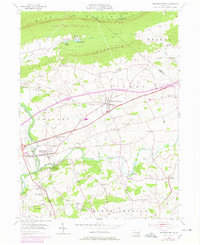
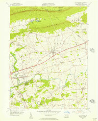
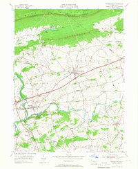
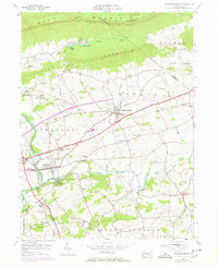
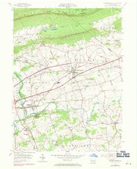
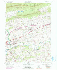
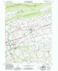
1955 Map of Fredericksburg
USGS Topo · Published 1978About this map
Blue Mountain and Little Mountain dominate the northern landscape of Lebanon County, where the Appalachian Trail winds through State Game Lands No 80. This region transitions from steep, forested ridges into a dense network of valley settlements and family-named landmarks. The mid-century development is visible through the Farmers Pride Airport near Fredericksburg and the sprawling Conrail lines that trace the southern edges of the mountains.
Find a feature on this map
70 named features on this map. Tap any name to fly to it.
Don’t see what you’re looking for? This feature index may not catch every label — zoom into the map to look around manually.
Map Details
Editions of this 1955 Fredericksburg Map
7 editions found
Other maps of this area

1891 · Lebanon
USGS Topo · 1:62,500

1892 · Lykens
USGS Topo · 1:62,500

1892 · Hummelstown
USGS Topo · 1:62,500

1892 · Pine Grove
USGS Topo · 1:62,500

1893 · Lykens
USGS Topo · 1:62,500

1893 · Lebanon
USGS Topo · 1:62,500

1899 · Lebanon
USGS Topo · 1:62,500

1924 · Hummelstown
USGS Topo · 1:62,500

1943 · Lebanon
USGS Topo · 1:62,500

1943 · Lykens
USGS Topo · 1:62,500
Featured Places
- Bethel Township, PA
- Jonestown, PA
- Union Township, PA
- Swatara Township, PA
- Fredericksburg, Bethel Township