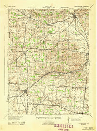
1943 Map of Fredericktown
USGS Topo · Published 1943About this map
Fredericktown serves as the primary municipal anchor of this wartime survey, situated at the junction of the Baltimore and Ohio RR and several local routes. The landscape is defined by its deep educational and social roots, evidenced by the high density of rural schoolhouses such as Woodland Hall Sch, Ball Sch, and Vail Sch. Near the Knox and Morrow county lines, the County Infirmary stands as a significant landmark of local social history.
Find a feature on this map
84 named features on this map. Tap any name to fly to it.
Don’t see what you’re looking for? This feature index may not catch every label — zoom into the map to look around manually.
Map Details
Editions of this 1943 Fredericktown Map
This is the sole edition of this map. No revisions or reprints were ever made.
Other maps of this area

1902 · Westerville
USGS Topo · 1:62,500

1904 · Westerville
USGS Topo · 1:62,500

1908 · Granville
USGS Topo · 1:62,500

1909 · Newark
USGS Topo · 1:62,500

1910 · Granville
USGS Topo · 1:62,500

1912 · Gambier
USGS Topo · 1:62,500
1912 · Perrysville
USGS Topo · 1:62,500
1913 · Mount Gilead
USGS Topo · 1:62,500

1914 · Gambier
USGS Topo · 1:62,500
1915 · Perrysville
USGS Topo · 1:62,500