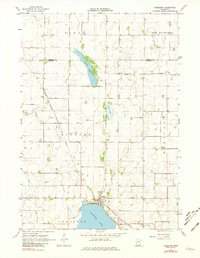
1967 Map of Freeborn
USGS Topo · Published 1981About this map
Freeborn Lake and the village of Freeborn anchor this mid-1960s survey of southern Minnesota. The landscape is defined by its sophisticated agricultural water management, evidenced by the extensive network of artificial waterways like Ditch No 8 and Judicial Ditch No 6 that support the surrounding townships of Byron and New Richland. The Chicago Milwaukee St Paul and Pacific railroad cuts a diagonal path through the terrain, connecting the local economy to the broader region. Local history is preserved in sites such as Freeborn Cem and the uniquely named Seven Day Cem. The natural hydrology, including Trenton Lake and the winding Cobb River, persists alongside the engineered drainage channels, showing the transition between the glacial prairie wetlands and modern farmland.
Find a feature on this map
22 named features on this map. Tap any name to fly to it.
Don’t see what you’re looking for? This feature index may not catch every label — zoom into the map to look around manually.
Map Details
Editions of this 1967 Freeborn Map
2 editions found
Other maps of this area

1954 · Albert Lea
USGS Topo · 1:62,500

1954 · Mason City
USGS Topo · 1:250,000

1955 · Wells
USGS Topo · 1:62,500

1957 · Mason City
USGS Topo · 1:250,000

1958 · Mason City
USGS Topo · 1:250,000

1967 · Waldorf
USGS Topo · 1:24,000

1967 · Freeborn
USGS Topo · 1:24,000
1967 · Otisco
USGS Topo · 1:24,000
1967 · Matawan
USGS Topo · 1:24,000

1967 · Hartland
USGS Topo · 1:24,000