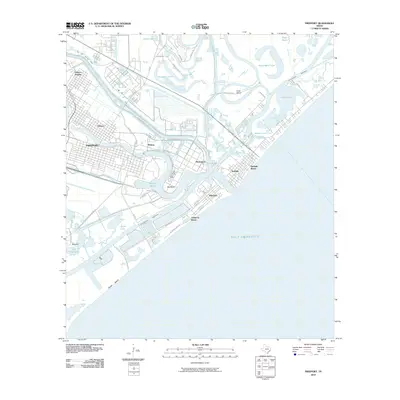
2010 Map of Freeport
USGS Topo · Published 2010About this map
Industrial infrastructure and coastal settlements define this region where the Old Brazos River meets the Gulf of Mexico. The town of Freeport and nearby Velasco sit at the heart of a complex network of man-made waterways and heavy industry, most notably the sprawling Dow Chemical Plant. This 2010 survey illustrates the deep integration of shipping and chemical production, with Brazos Harbor and the Intracoastal Waterway facilitating large-scale maritime transit.
Find a feature on this map
53 named features on this map. Tap any name to fly to it.
Don’t see what you’re looking for? This feature index may not catch every label — zoom into the map to look around manually.
Map Details
Editions of this 2010 Freeport Map
This is the sole edition of this map. No revisions or reprints were ever made.
Other maps of this area

1943 · Oyster Creek
USGS Topo · 1:31,680

1943 · Jones Creek
USGS Topo · 1:31,680

1943 · Freeport
USGS Topo · 1:31,680

1943 · Cedar Lakes East
USGS Topo · 1:24,000

1943 · Christmas Point
USGS Topo · 1:24,000

1943 · Snipe
USGS Topo · 1:31,680

1950 · Houston
USGS Topo · 1:250,000

1951 · Bay City
USGS Topo · 1:250,000

1956 · Houston
USGS Topo · 1:250,000

1956 · Bay City
USGS Topo · 1:250,000