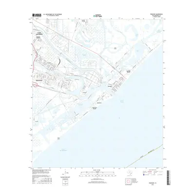
2016 Map of Freeport
USGS Topo · Published 2016About this map
The Freeport and Lake Jackson industrial coastline is defined by the massive footprint of the Dow Chemical Plant and Dow Operations Plant B. This complex sits amidst a labyrinth of engineered waterways, including the Intracoastal Waterway and the Freeport Harbor Channel, which facilitate the region's heavy maritime traffic. The map shows the legacy of the area's hydraulic history, where the Old Brazos River loops toward Brazos Harbor near the Big Bend. Along the shore, residential and recreational clusters like Surfside Beach, Quintana, and Quintana Beach provide a distinct contrast to the industrial zones, clinging to the thin barrier between the Gulf of Mexico and the inland bayous and lakes like Fresh Water Lake and Swan Lake.
Find a feature on this map
139 named features on this map. Tap any name to fly to it.
Don’t see what you’re looking for? This feature index may not catch every label — zoom into the map to look around manually.
Map Details
Editions of this 2016 Freeport Map
This is the sole edition of this map. No revisions or reprints were ever made.
Other maps of this area

1943 · Oyster Creek
USGS Topo · 1:31,680

1943 · Jones Creek
USGS Topo · 1:31,680

1943 · Freeport
USGS Topo · 1:31,680

1943 · Cedar Lakes East
USGS Topo · 1:24,000

1943 · Christmas Point
USGS Topo · 1:24,000

1943 · Snipe
USGS Topo · 1:31,680

1950 · Houston
USGS Topo · 1:250,000

1951 · Bay City
USGS Topo · 1:250,000

1956 · Houston
USGS Topo · 1:250,000

1956 · Bay City
USGS Topo · 1:250,000