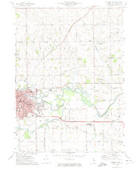
1971 Map of Freeport East
USGS Topo · Published 1974About this map
The industrial and civic center of Freeport dominates the western edge of this landscape, where the Pecatonica River winds through a broad floodplain marked by sewage disposal ponds and several gravel pits. In the early 1970s, the city’s footprint included numerous religious and social landmarks, such as the St. Vincent Children's Home, St. Joseph's School, and the courthouse at the heart of the settlement. To the south, Yellow Creek joins the river system near the Freeport Albertus Airport, illustrating the city's role as a regional transportation hub during this era.
Find a feature on this map
54 named features on this map. Tap any name to fly to it.
Don’t see what you’re looking for? This feature index may not catch every label — zoom into the map to look around manually.
Map Details
Editions of this 1971 Freeport East Map
2 editions found
Other maps of this area

1922 · Oregon
USGS Topo · 1:62,500

1924 · Oregon
USGS Topo · 1:62,500

1932 · Pecatonica
USGS Topo · 1:62,500

1936 · Pecatonica
USGS Topo · 1:62,500

1939 · Freeport
USGS Topo · 1:48,000

1942 · Forreston
USGS Topo · 1:62,500

1944 · Freeport
USGS Topo · 1:62,500

1945 · Forreston
USGS Topo · 1:62,500

1954 · Rockford
USGS Topo · 1:250,000

1955 · Rockford
USGS Topo · 1:250,000