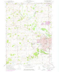
1971 Map of Freeport West
USGS Topo · Published 1978About this map
The Pecatonica River winds through this 1970s landscape, defining the transition from the city of Freeport to the agricultural townships of Harlem and Florence. Urban growth is evident along the eastern edge, where the Highland Community College campus and residential developments like La Cresta meet the established municipal infrastructure. Further north, the small settlements of Scioto Mills and Cedarville maintain their distinct identities along the Illinois Central Gulf railroad and Richland Creek.
Find a feature on this map
64 named features on this map. Tap any name to fly to it.
Don’t see what you’re looking for? This feature index may not catch every label — zoom into the map to look around manually.
Map Details
Editions of this 1971 Freeport West Map
2 editions found
Other maps of this area

1937 · Lena
USGS Topo · 1:48,000

1939 · Freeport
USGS Topo · 1:48,000

1942 · Mt Carroll
USGS Topo · 1:62,500

1942 · Lena
USGS Topo · 1:62,500

1942 · Forreston
USGS Topo · 1:62,500

1943 · Lena
USGS Topo · 1:62,500

1944 · Mt Carroll
USGS Topo · 1:62,500

1944 · Freeport
USGS Topo · 1:62,500

1945 · Forreston
USGS Topo · 1:62,500

1954 · Rockford
USGS Topo · 1:250,000