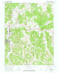
1965 Map of French Lick
USGS Topo · Published 1966About this map
French Lick and West Baden Springs anchor this mid-century survey of Orange County, showing the region just as the expansion of the Hoosier National Forest was shaping the surrounding timberlands. The landscape is defined by the winding course of the Lost River and its complex network of drainage basins, including Stillhouse Hollow and Pipher Hollow. Cultural heritage is evident in the numerous rural landmarks, from the Ames Chapel near the northern border to the Moores Ridge Ch in the south. The transportation infrastructure reveals the legacy of the Monon and Southern railroad lines, which historically supported the area's famous resort economy. Of particular interest to historians is the Old Indian Treaty Boundary cutting through the southeast, marking a significant early 19th-century survey line that still dictated property divisions and land use decades later.
Find a feature on this map
41 named features on this map. Tap any name to fly to it.
Don’t see what you’re looking for? This feature index may not catch every label — zoom into the map to look around manually.
Map Details
Editions of this 1965 French Lick Map
4 editions found
Other maps of this area

1948 · Huron
USGS Topo · 1:24,000

1949 · Georgia
USGS Topo · 1:24,000

1950 · Mitchell
USGS Topo · 1:24,000

1950 · Huron
USGS Topo · 1:24,000

1950 · Valeene
USGS Topo · 1:24,000

1951 · Hillham
USGS Topo · 1:24,000

1951 · French Lick
USGS Topo · 1:24,000

1951 · Georgia
USGS Topo · 1:24,000

1956 · Greenbrier
USGS Topo · 1:24,000

1956 · Vincennes
USGS Topo · 1:250,000