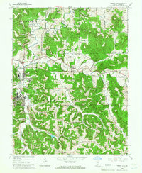
1965 Map of French Lick
USGS Topo · Published 1973About this map
The resort towns of French Lick and West Baden Springs anchor this mid-1960s landscape, where the famous mineral spring heritage is evident in the dense street grids and established infrastructure. This area serves as a significant rail junction, featuring both the Monon and Southern railroads which historically brought visitors to the local hotels and moved timber from the surrounding Hoosier National Forest.
Find a feature on this map
38 named features on this map. Tap any name to fly to it.
Don’t see what you’re looking for? This feature index may not catch every label — zoom into the map to look around manually.
Map Details
Editions of this 1965 French Lick Map
4 editions found
Other maps of this area

1948 · Huron
USGS Topo · 1:24,000

1949 · Georgia
USGS Topo · 1:24,000

1950 · Mitchell
USGS Topo · 1:24,000

1950 · Huron
USGS Topo · 1:24,000

1950 · Valeene
USGS Topo · 1:24,000

1951 · Hillham
USGS Topo · 1:24,000

1951 · French Lick
USGS Topo · 1:24,000

1951 · Georgia
USGS Topo · 1:24,000

1956 · Greenbrier
USGS Topo · 1:24,000

1956 · Vincennes
USGS Topo · 1:250,000