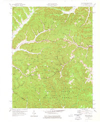
1977 Map of Frenchburg
USGS Topo · Published 1978About this map
Frenchburg serves as the primary hub in this corner of the Daniel Boone National Forest, positioned at the junction where Beaver Creek meets Slate Creek. The 1970s landscape is heavily marked by the energy economy of the Cumberland Plateau, with numerous Gas Wells and Oil Wells scattered across the heavily dissected ridges and hollows. These industrial features sit alongside established community landmarks, including the County High Sch and several family-named burial sites such as the Reffitt Cem and Slusher Cem.
Find a feature on this map
84 named features on this map. Tap any name to fly to it.
Don’t see what you’re looking for? This feature index may not catch every label — zoom into the map to look around manually.
Map Details
Editions of this 1977 Frenchburg Map
This is the sole edition of this map. No revisions or reprints were ever made.
Other maps of this area

1892 · Beattyville
USGS Topo · 1:125,000

1929 · Salt Lick
USGS Topo · 1:62,500

1934 · Salt Lick
USGS Topo · 1:62,500

1951 · Pomeroyton
USGS Topo · 1:24,000

1952 · Preston
USGS Topo · 1:24,000

1952 · Scranton
USGS Topo · 1:24,000

1952 · Frenchburg
USGS Topo · 1:24,000

1952 · Stanton
USGS Topo · 1:24,000

1952 · Means
USGS Topo · 1:24,000

1952 · Slade
USGS Topo · 1:24,000