
Loading...
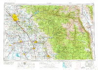
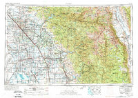
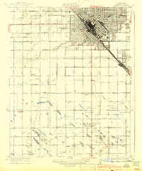
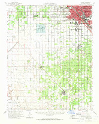
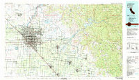
Loading map...1962 Map of Fresno
USGS Topo · Published 1968About this map
Mount Whitney towers over the Sierra Nevada range in this 1960s study of the Central Valley and its eastern mountain barrier. The geography is defined by a massive irrigation network, tracing the flow of the Kings River, San Joaquin River, and Tule River into the agricultural heartland. On the valley floor, the extent of the Tulare Lake Bed remains visible alongside man-made landmarks like Friant Dam and the Lemoore U.S. Naval Air Station.
Find a feature on this map
228 named features on this map. Tap any name to fly to it.
Don’t see what you’re looking for? This feature index may not catch every label — zoom into the map to look around manually.
Map Details
Date Portrayed1962
Date Published1968
PublisherU.S. Geological Survey
Map TypeTopographic
Scale1:250000
Physical Dimensions31.4 x 22.5 inches
Editions of this 1962 Fresno Map
3 editions found
Historical Maps of Nanceville Through Time
10 maps found


Featured Locations
Source Details
SourceU.S. Geological Survey
CopyrightPublic Domain