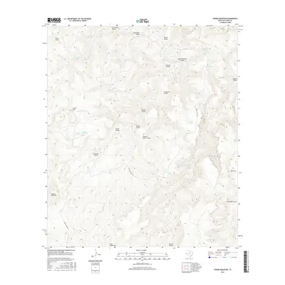
2016 Map of Friend Mountain
USGS Topo · Published 2016About this map
Davis Mountains topography dominates this section of West Texas, where a complex network of canyons and high peaks defines the landscape. The namesake Friend Mtn stands as a central landmark, supported by water sources like Friend Mountain Tank and Water Reed Tank. These water features, alongside various tanks and springs such as Bonanza Spring and Deadman Tank, were critical for ranching operations in this arid environment. The presence of Caldwell Ranch Rd provides the primary transit route through the high country, connecting remote canyon floors with the ridgelines. Evocative place names like Robbers Roost Canyon, Bootlegger Canyon, and Eagle Waterhole Canyon suggest a storied local history involving isolation and frontier survival, while landforms like Bear Mtn and Robbers Roost Mtn anchor the rugged geography of Jeff Davis County.
Find a feature on this map
30 named features on this map. Tap any name to fly to it.
Don’t see what you’re looking for? This feature index may not catch every label — zoom into the map to look around manually.
Map Details
Editions of this 2016 Friend Mountain Map
This is the sole edition of this map. No revisions or reprints were ever made.
Other maps of this area

1894 · Valentine
USGS Topo · 1:125,000

1894 · Fort Davis
USGS Topo · 1:125,000

1897 · Valentine
USGS Topo · 1:125,000

1897 · Fort Davis
USGS Topo · 1:125,000

1943 · Valentine
USGS Topo · 1:125,000

1954 · Fort Stockton
USGS Topo · 1:250,000

1958 · Fort Stockton
USGS Topo · 1:250,000

1959 · Marfa
USGS Topo · 1:250,000

1965 · Marfa
USGS Topo · 1:250,000

1972 · Casket Mountain
USGS Topo · 1:24,000