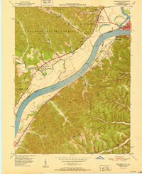
1951 Map of Friendship
USGS Topo · Published 1951About this map
Shawnee State Forest dominates the hills above the Ohio River in this early 1950s survey of the border region between Ohio and Kentucky. The landscape is defined by its deep drainage networks, including Turkey Creek and Carey Run, where small settlements like Friendship and Sugar Grove sit at the mouths of hollows. Transportation is centered on the river corridor, where the Chesapeake and Ohio railroad runs along the southern bank through South Portsmouth and Firebrick.
Find a feature on this map
94 named features on this map. Tap any name to fly to it.
Don’t see what you’re looking for? This feature index may not catch every label — zoom into the map to look around manually.
Map Details
Editions of this 1951 Friendship Map
2 editions found
Other maps of this area

1911 · Sciotoville
USGS Topo · 1:62,500

1913 · Sciotoville
USGS Topo · 1:62,500

1915 · Garrison
USGS Topo · 1:62,500

1915 · Otway
USGS Topo · 1:62,500

1917 · Otway
USGS Topo · 1:62,500

1918 · Garrison
USGS Topo · 1:62,500

1926 · Greenup
USGS Topo · 1:48,000

1930 · Greenup
USGS Topo · 1:62,500

1949 · Pond Run
USGS Topo · 1:24,000

1949 · Garrison
USGS Topo · 1:24,000