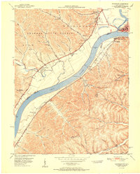
1951 Map of Friendship
USGS Topo · Published 1951About this map
Shawnee State Forest dominates the rugged hills north of the Ohio River, where a network of hollows and runs defines the settlement patterns of the early 1950s. The community of Friendship sits at the junction of Worley Run and Turkey Creek, serving as a central point for the surrounding rural homesteads. Across the water in Kentucky, the Chesapeake and Ohio railroad tracks follow the river's bend, connecting industrial points like Firebrick and South Portsmouth. This survey captures a moment when the river-based economy was still deeply integrated with local infrastructure, evidenced by Lock Dam No 31 and the Raven Rock Airport perched near the bluffs. Genealogists will find a wealth of local identifiers, from family-named cemeteries like Vaughters Cem to local landmarks such as the County Home and several rural schoolhouses.
Find a feature on this map
98 named features on this map. Tap any name to fly to it.
Don’t see what you’re looking for? This feature index may not catch every label — zoom into the map to look around manually.
Map Details
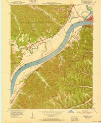
Editions of this 1951 Friendship Map
2 editions found
Other maps of this area

1911 · Sciotoville
USGS Topo · 1:62,500

1913 · Sciotoville
USGS Topo · 1:62,500

1915 · Garrison
USGS Topo · 1:62,500

1915 · Otway
USGS Topo · 1:62,500

1917 · Otway
USGS Topo · 1:62,500

1918 · Garrison
USGS Topo · 1:62,500

1926 · Greenup
USGS Topo · 1:48,000

1930 · Greenup
USGS Topo · 1:62,500

1949 · Pond Run
USGS Topo · 1:24,000

1949 · Garrison
USGS Topo · 1:24,000