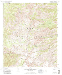
1967 Map of Fritz Canyon
USGS Topo · Published 1982About this map
The Blue River carves a deep path through the heart of the Apache National Forest, anchoring a landscape defined by dramatic drainages and isolated springs. This 1967 survey captures the area when ranching operations like Fritz Ranch and Stacy Ranch were the primary human markers in this backcountry. The terrain is marked by significant vertical relief, from the heights of Alder Peak and Pinon Mtn down into named draws such as Hobo Canyon and Suicide Canyon. Water management is central to the land's utility, evidenced by a network of tanks including Jump Up Tank and Horse Canyon Ridge Tank. For researchers, the map preserves the exact locations of numerous remote water sources like Wild Bunch Springs and Holding Cienega Spring, which supported livestock and wildlife long before modern development altered the region's character.
Find a feature on this map
43 named features on this map. Tap any name to fly to it.
Don’t see what you’re looking for? This feature index may not catch every label — zoom into the map to look around manually.
Map Details
Editions of this 1967 Fritz Canyon Map
3 editions found
Other maps of this area

1902 · Clifton
USGS Topo · 1:62,500

1913 · Morenci
USGS Topo · 1:125,000

1915 · Morenci
USGS Topo · 1:125,000

1954 · Clifton
USGS Topo · 1:250,000

1957 · Clifton
USGS Topo · 1:250,000

1958 · Clifton
USGS Topo · 1:250,000

1962 · Clifton
USGS Topo · 1:250,000

1962 · Clifton
USGS Topo · 1:62,500

1962 · Big Lue Mts
USGS Topo · 1:62,500
1967 · Alma Mesa
USGS Topo · 1:24,000