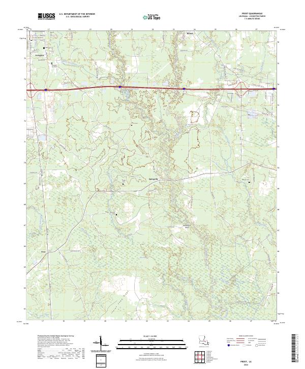
2024 Map of Frost
USGS Topo · Published 2024About this map
Livingston anchors the northern portion of this Livingston Parish landscape, where the town's grid meets the surrounding lowlands and the Tickfaw River corridor. The geography is defined by a complex network of waterways, including Little Colyell Creek to the west and the expansive Gum Swamp that dominates the central terrain. This area preserves a significant record of local families through its numerous small burial grounds, such as the Zeigler Cem, Smiley - Davidson Cem, and McLin Cem. To the south, the terrain transitions into the distinct elevations of Saulsettoon Bluff and Indian Camp Ridge, overlooking the winding courses of Edwards Bayou and Bridge Bayou. The settlement pattern follows established routes like S Frost Rd connecting the smaller communities of Springville and Frost, illustrating the rural development of the parish away from the primary transport corridors.
Find a feature on this map
83 named features on this map. Tap any name to fly to it.
Don’t see what you’re looking for? This feature index may not catch every label — zoom into the map to look around manually.
Map Details
Editions of this 2024 Frost Map
This is the sole edition of this map. No revisions or reprints were ever made.
Other maps of this area

1934 · Denham Springs
USGS Topo · 1:62,500

1934 · Springfield
USGS Topo · 1:62,500

1939 · Springfield
USGS Topo · 1:62,500

1939 · Denham Springs
USGS Topo · 1:62,500

1942 · Satsuma
USGS Topo · 1:31,680

1949 · Albany
USGS Topo · 1:31,680

1950 · Doyle
USGS Topo · 1:31,680

1953 · Walker
USGS Topo · 1:24,000
1953 · French Settlement
USGS Topo · 1:24,000
1953 · Satsuma
USGS Topo · 1:24,000